AN GIANG PROVINCE, SOUTHERN VIETNAM
General Information About An Giang Province
Capital: Long Xuyên
Area: 3,536.68 km2
Population: 1,908,352 people (2019 Census)
Density: 540/km2
Demographics: Ethnicities Vietnamese, Khmer, Cham, Hoa
Calling code: 296
Website: www.angiang.gov.vn
An Giang is a province of Vietnam. It is in the Mekong Delta, in the southwestern part of the country, sharing a border with Cambodia to the northwest.
An Giang first became a province in 1832, having been settled by ethnically Vietnamese migrants moving southwards in search of new land. In fact, An Giang was once an important centre of the vanished Oc Eo culture, presumably owing to its position on the river. Traditionally, An Giang has been known for its silk industry.
An Giang is a home to a sizable number of people from Vietnam’s ethnic minorities. Due to the province’s proximity to Cambodia, the Khmer Krom are the largest non-Vietnamese group. Other groups, such as the Cham and ethnic Chinese (Hoa), are also found in An Giang.
The Ba Chuc massacre of April 1978, in that border province with Cambodia. On the day the Khmer Rouge began its series of border raids, April 15, 1978, Ba Chuc was a quiet little village of about 3,500 people. For two weeks, ending April 30, 1978, the Khmer Rouge tore through Ba Chuc slicing to bits anything that breathed, literally ripping apart young children limb from limb and hacking the adults to pieces with machetes. When the raids ceased the population of Ba Chuc reduced to half.
Geography
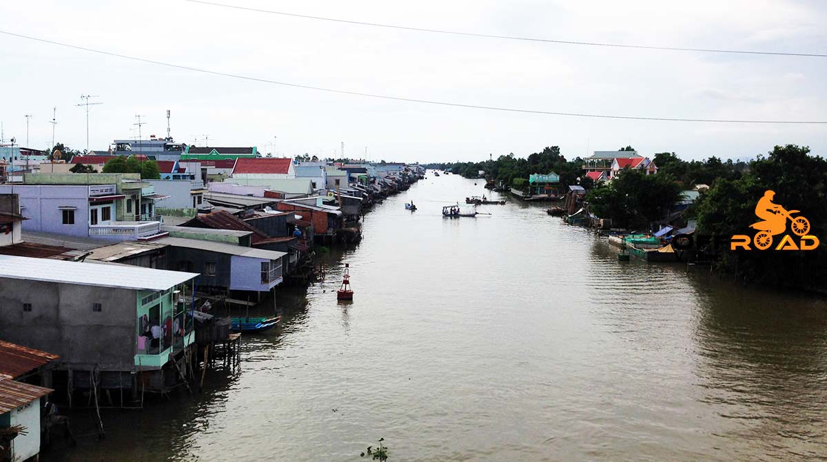
An Giang occupies a position in the upper reaches of the Mekong Delta. The Hau Giang and Tien Giang branches of the Mekong River are the dominant geographical features of the province. With the exception of the west, most of An Giang is fairly flat and is crisscrossed by many canals and small rivers. This terrain has led to An Giang being a significant agricultural centre, producing significant quantities of rice. The Cam Mountains, also known as the That Son range or the “Seven Mountains”, are located in the western Tinh Bien District. Followers of the Buu Son Ky Huong tradition, founded in An Giang in 1849, refer to these mountains as Buu Son, “Precious Mountains”.
An Giang Province Administration
An Giang is subdivided into 11 district-level sub-divisions:
Districts
An Phu: 2 towns and 12 rural communes
Chau Phu: 1 town and 12 rural communes
Chau Thanh: 1 town and 12 rural communes
Cho Moi: 2 towns and 16 rural communes
Phu Tan: 2 towns and 16 rural communes
Thoai Son: 3 towns and 14 rural communes
Tinh Bien: 3 towns and 11 rural communes
Tri Ton: 2 towns and 13 rural communes
District-level town
Tan Chau: 5 wards and 9 rural communes
Provincial cities
Chau Doc: 5 wards and 2 rural communes
Long Xuyen: 11 wards and 2 rural communes (capital of the province)
They are further subdivided into 16 commune-level towns (or townlets), 119 communes, and 21 wards (156 in total).
For more details about other provinces and cities of Vietnam, please follow this link.

Leave A Comment